As winter releases its grip on the Front Range, the trails beckon. But early spring brings a catch: snowmelt and lingering mud can turn a perfect hike into a cleanup nightmare. This guide points you toward the trails that actually dry fast—terrain that keeps both paws and boots clean while you explore.
Why Mud Matters (More Than You'd Think)
Muddy trails sound minor until you're scrubbing your dog's legs at home. But it's bigger than that:
- Paw health: Mud cakes between toes, hides sharp objects, and can cause irritation or cuts.
- Trail damage: Hikers step onto drier edges to avoid mud, widening trails and eroding sensitive ground.
- Invasive species: Mud spreads seeds and pathogens that damage the ecosystem.
The solution? Stick to terrain that drains fast and dries hard—fast-draining geology, rocky composition, or natural elevation that sheds water quickly.
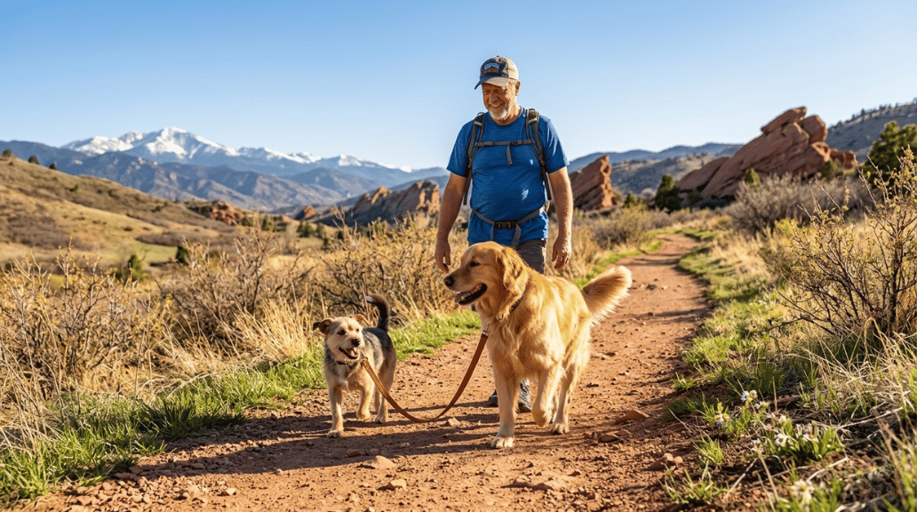
The Best Mud-Free Trails Near Denver This Spring
All of these trails are accessible in May and prioritize naturally quick-drying conditions.
Mount Falcon Park (Morrison) — Moderate Difficulty
The route: Castle Trail loop, lower elevations
Why it drains fast: Rocky terrain + sun exposure = firm ground
Distance: ~3.5 miles (loop)
Best time to visit: Early morning (ground is firmest before sun softens residual moisture)
Mount Falcon offers several terrain options, but focus on the lower Castle Trail loop for spring. The rocky composition and open sun exposure mean water doesn't sit here—it drains and dries.
Parking: East trailhead has plenty of spaces
Leash requirements: Leash required—Jefferson County Open Space enforces this strictly for wildlife protection
Pro tip: Start early. Ground conditions soften as the day warms.
Flatirons Vista (Boulder) — Easy to Moderate
The route: Vista trail to viewpoint
Why it drains fast: Grassland terrain with no deep forest shade
Distance: ~2–3 miles (depending on route)
Best time to visit: Any time; this exposure is actually an advantage
Boulder's higher trails stay muddy through May, but Flatirons Vista—just south of Boulder off Highway 93—sits lower and drier. Grassland means excellent drainage and rapid drying.
Parking: Trailhead off Highway 93
Off-leash rules: Dogs need a Voice and Sight tag to roam off-leash in designated Boulder Open Space areas. No tag? Keep your dog leashed.
What to bring: Water bowl (fewer water sources at this elevation)
Matthews/Winters Park & Red Rocks Trail (Golden/Morrison) — Easy to Moderate
The route: Red Rocks Trail segment
Why it drains fast: Red sandstone is naturally porous and absorbs water like a sponge
Distance: ~2–4 miles (multiple loop options)
Best time to visit: Mid-morning to afternoon (stone warms and dries fastest in sun)
Red sandstone is your friend in spring. Unlike dirt or clay, it's porous and sheds water efficiently. The Red Rocks Trail segment connects Matthews/Winters to the iconic Red Rocks Amphitheatre area with reliably dry footing.
Parking: Multiple lots available; main Matthews/Winters trailhead is easiest
Leash requirements: Leash mandatory—Jefferson County Open Space rules
Scenery: Iconic red formations make this worth the drive
Gateway Mesa Open Space (Castle Rock) — Easy
The route: Main 1.8-mile loop
Why it drains fast: Gravelly, well-maintained path with open terrain
Distance: 1.8 miles (loop)
Best for: Older dogs, dogs new to Colorado altitude, or a relaxed outing
Gateway Mesa doesn't get the hype of bigger trails, but it's perfect for spring. The gravelly path naturally resists deep mud, and the open terrain means quick drying. It's relatively flat, making it ideal if your dog is adjusting to Colorado elevation.
Parking: Trailhead off Castleton Road
Leash requirements: Check Castle Rock Open Space regulations (leash likely required)
Scenery: Panoramic views despite low elevation
Trail Etiquette: Non-Negotiable Rules
Responsible hiking protects both trails and future access.
Leash laws: Know the rules before you go. When in doubt, leash.
Waste removal: Pack out every bag. Leaving waste bags on trails or not picking up is unacceptable and kills trail access for future hikers.
Water and hydration: Carry water for both you and your dog. Spring sun on dry trails can still dehydrate fast.
Check conditions before you go: Use the Colorado Trail Explorer (COTREX) app for real-time updates on mud, closures, and conditions.
Wildlife control: Keep your dog close. Your pet's safety and the ecosystem depend on it.
Resources for Planning
- Colorado Trail Explorer (COTREX): https://cotrex.state.co.us/ — Real-time trail conditions, mud reports, and closures
- Jefferson County Open Space: https://www.jeffco.us/1523/Open-Space-Regulations — Leash laws and visitor rules
- Boulder OSMP Voice and Sight Program: https://bouldercolorado.gov/services/voice-and-sight-program — Boulder's off-leash requirements
- Colorado Parks and Wildlife: https://cpw.state.co.us/learn/Pages/DogParkEtiquette.aspx — Statewide responsible hiking guidelines
The Takeaway
May is the sweet spot on the Front Range—trails are open, crowds haven't arrived, and if you choose carefully, mud isn't an issue. These trails give you fast-drying terrain, clear visibility, and scenery that reminds you why Colorado living beats everywhere else. Pick one, check the conditions, and go.